I think I’ve talked about this on forums, but the actual blog post I meant to write (months ago) has been sitting in my ‘drafts’ folder and it’s so obsolete that I’m just going to start again. So…
As you may have heard, X-Plane 10 is going to use OpenStreetMap (OSM) as our data source for vector road data and some fraction of our vector water-body data. X-Plane 9 uses TIGER and VMAP0, so switching to OSM will be a huge improvement.
If you haven’t looked at OSM, the very short version is that it’s a cross between Google Maps and Wikipedia: it’s a global map of vector data that anyone can edit. And unlike Google Maps, anyone can get the actual vector data and use it for any purpose. This makes OSM useful for creating global scenery.
Here is a comparison of downtown Paris in VMAP0 and OSM.
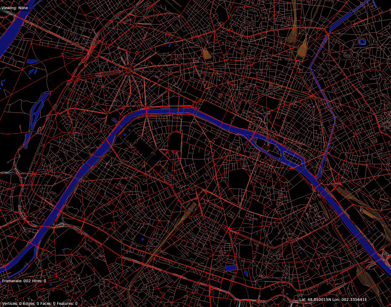

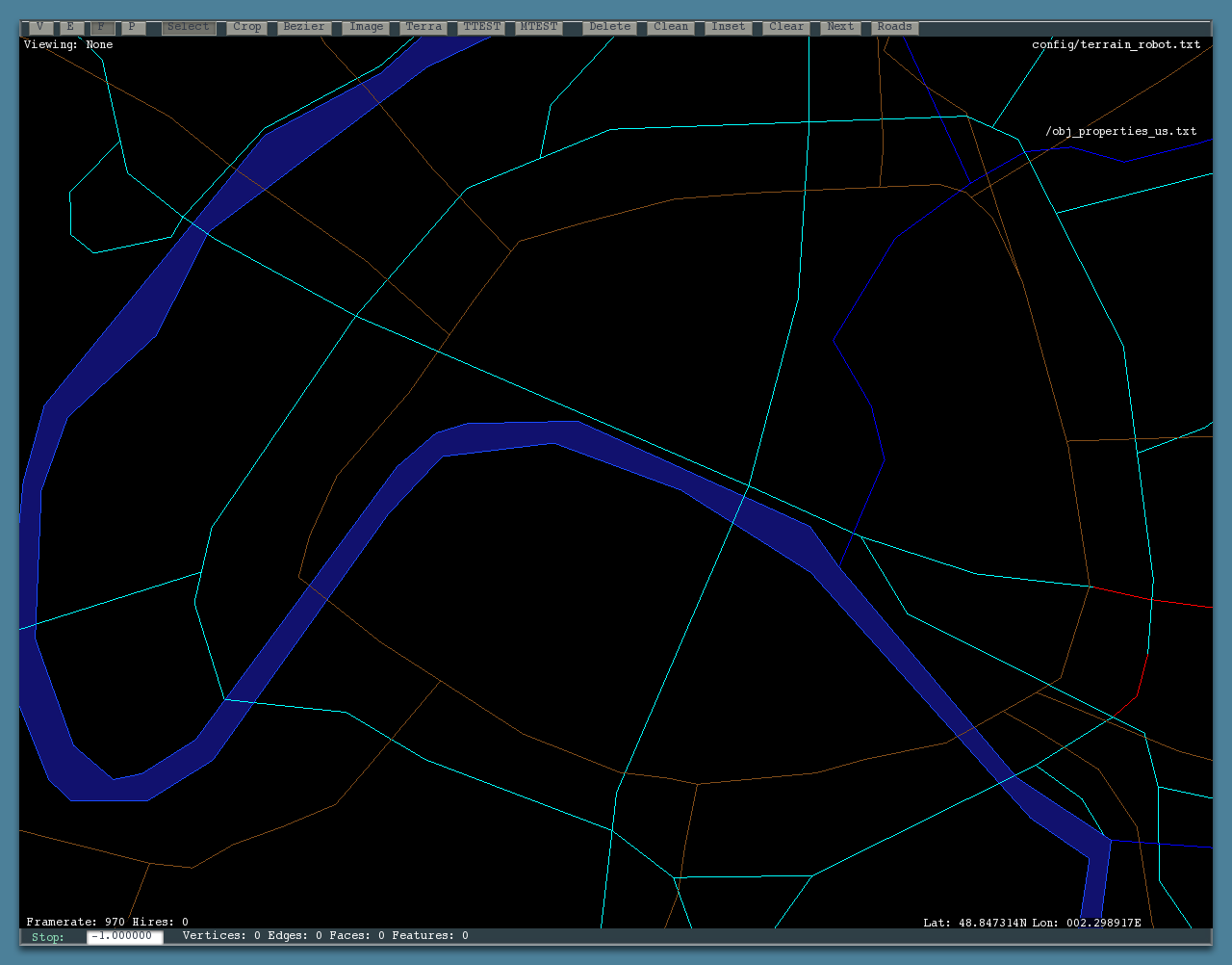

(That’s the 48N 2E tile, which contains Paris. The top images are a whole-tile and metro image from VMAP0, and the bottom are the same areas in OSM.)
There are two big wins with OSM:
- OSM contains significantly better road data in every part of the world. In the US, we had a complete road grid via TIGER, but OSM has been improved to contain direction-of-travel and bridge information. This extra information allows us to construct a much more plausible road system. In Europe the win is incomparable: we are going from having virtually no vector data to having the complete road grid of many major European cities.
- More importantly, OSM provides all of the infrastructure to improve the data. You can directly edit OSM either on your own machine (via JOSM) or directly in your web browser (via Potlatch). OSM has the infrastructure to accept changes, track changes, and the management infrastructure to view history, revert mistakes, and accept many edits from a huge user base simultaneously. Their servers to accept edits are already running and maintained.
I can’t emphasize the importance of this second point enough. In the eight years since I first started poking my nose into X-Plane scenery, I have heard this more times than I can count: “The lake near my house is in the wrong place. Can I fix it and send you the fix”?
Until now the answer has been: no. The lake comes from a data set and when we recut the scenery, any user edits would be destroyed by the conversion from source data. OSM changes that. OSM is the source data, so if you improve global data within OSM, you have fixed the problem permanently.
Not only does OSM make it easy to fix problems permanently, but OSM makes it easy to make very small changes. This morning I was viewing my own town and discovered that two railroad bridges were not marked. I clicked the edit tab, marked out the bridges, and saved my change. You can start with a single edit.
By connecting X-Plane’s source data to the OpenStreetMap community, we can join forces with many other communities that are all working to improve the availability of global mapping data; our improvements (for the sake of improving X-Plane) can help other groups that are working on completely different projects, and their improvements benefit us.
In future posts I will address some of the details of what data we are using, how you can contribute in ways that will affect the global scenery, and how we are (trying) to cope with the OSM licensing change. But I want to make one point immediately:
Just because the global scenery will use OSM does not mean that global scenery will be the only way to use OSM. There are already several existing projects (e.g. XPOSM and OSM2XP) that will build custom scenery from OSM data. OSM provides a rich and detailed geodatabase; the global scenery is only beginning to scratch the surface of what can be done with the data. So I do not see our use of OSM as making some of the other OSM/X-Plane projects obsolete.
For example, OSM2XP utilizes OSM building data, which we will not be using in the version 10 global scenery. I think that the more tools we have to use OSM data, the better, as they give authors more choice in creating scenery.
“OSM is the source data, so if you improve global data within OSM, you have fixed the problem permanently.”
But after the new scenery (together with the new X-Plane version) is released, we won’t be able to see any correction until the next version, right?
It seems that in FlightGear we have an update server wich allows us to keep our local scenery always up-to-date (with new landmarks, for example). Can’t we have something like this, maybe?
As soon as the official scenery is updated/fixed/etc, the users will also be able to receive this updated.
More on that coming in tomorrow’s post!
Good! Thanks! 😀
Just one more doubt: you say that OSM is being used for road and water. But will it also be used to get the terrain type? For example, an area that is made of grass (that is mapped in OSM) inside a city.
More on that in the next few days. But short answer: mostly not. Alpilotx has built up raster land class data from a number of very high quality data sources, and that will be what mostly drives land class. But more info soon.
Thank you very much for the news, Ben! Nice to hear about the development progress!
I like very much the concept of OSM usage. I don’t see a large problem in getting updated data. For example, we may see a new subversion of X-Plane every month os so, and that updates will include current OSM data converted to X-Place scenery data. I think, this is a reasonable period.
Waiting patiently for the new version as long as it is required by you all to implement the new stuff )
Sorry, please read X-Plane instead of X-Place )
Ben, will the OSM data be applied worldwide, so us Aussies will also see the benefits? Not that we have many roads, just bush tracks 🙂
Will OSM data be used to at least guide the type of buildings generated?
Thanks for the info
Worldwide: yes.
Buidlings: no. More on that in future posts, but baby steps. There are a lot of problems with using building data world-wide..we have to fit on less than a gajillion DVDs. I think OSM2XP can make custom sceneries to add that data in.
The main problem with buildings in open street map is coverage.
Some parts of the world are very detailled (France, eastern europe as exemple), when United States are nearly empty.
It would be the major concern for xplane global scenery in my opinion.
So yes osm2xp can make custom scenery matching xposm roads/xplane10 osm roads, as long as you want a zone where open street maps buildings data is rich enough.
There’s also the possibility to add buildings data to your local area, that’s what the italian xplane community is doing.
Xplane 10 new facades spec will also help generating better looking buildings from osm data, i think i should be able to release an enhanced Osm2XP version a few days after xplane10 is out.
Hi Benny,
Well, for osm2xp the problem is coverage — for the global scenery the problem is DVD space. 😉 That is, we cannot afford to create one facade per building and still fit on disk. But yes, coverage in OSM can be a problem too, for any data layer.
The facade 2 engine will allow for nicer buildings, but it may not be appropriate for OSM…it generates more polygons to create those nice buildings. It’s really intended for airports.
But there are also some facade upgrades for both types of facades, so even with the ‘cheaper’ ones there will be some tricks you can use!
+1 for excitement about the use of OpenStreetmap data! Somehow working with OSM in my local area has turned into a bit of an obsession, and I’ve spent well over 150 hours over the past year working with my local area importing high quality water data, correcting the roads and railroads to sattelite imagery, and ensuring that bridges and one-ways were tagged appropriately. I’m excited to see that it’s going to run head first into what’s in the in-the-box install of X-Plane in the future!
So does this mean that as OSM evolves, will we see enhancements throughout the XP10 run, Ben? Kind of like we see constant improvements through Robin Peel’s efforts with the airport and navigation databases.
I don’t know. We do not have a plan or commitment to release scenery between major versions at this point. OSM solves the problem of accepting edits but not redistributing them.
I use OSM allready with the help of OSM2XP. What about the car on the road ? If we have all the road that OSM has, there will be a lot of car driving around. Could we select how many fonction of the size of the road ?
Ha Dan 31, also can it simulate the darned traffic jams! In Melb. we call the Sth Eastern Arterial the SE Carpark..
This probably is the most interesting post this quarter, really looking forward to more details re buildings, what algorithms are at play etc. Great work, Ben!
Finally some cool news, very excited to have a much more realistic ground world and roads.
just an idea here, and i am sure maybe someone has thought of it already, but when it comes to buildings, would it not be a nice idea to have an open database for that as well? perhaps one made specifically for xplane. something like what google has on google earth. and instead of having all the data installed with xplane, have it download on the fly, which will save a lot on DVD cost.
This way, the community can slowly but surely update the world scenery with custom buildings, etc.
and for bandwidth, if you keep the building sizes low, say a few polygons and 256×256 texture sizes, and then bundle up whole areas into one object, that may just work no?
just an idea, but like i said, maybe you guys have thought of this already.
Perhaps some day – a number of people have looked at this, both online and offline, in X-Plane and in other sim and non-sim communities!
Thinking through this, this offers some amazing opportunities to generate scenery. A couple of applications could be that relations defined for Amtrak (http://wiki.openstreetmap.org/wiki/Amtrak) could send passenger trains along their respective routes. Major highway interchanges that have layers on bridges could automatically generate beautiful multi-layered interchanges. Cars on the highways could obey speed limits should they exist. Buildings have been widely discussed but at least in the US and rural areas is quite difficult to come by. Gosh, this kind of system could be the basis for an exquisite, community-driven world simulator. You guys should make a Train Sim from this data. 😉