If you have a computer that can handle more detailed base meshes, AlpilotX’s free HD and (for those with serious hardware, UHD) meshes are a really great looking enhancement to X-Plane. Alpilotx just released a new HD version of South America with more up-to-date land class and OSM data.
Here are comparison screenshots.
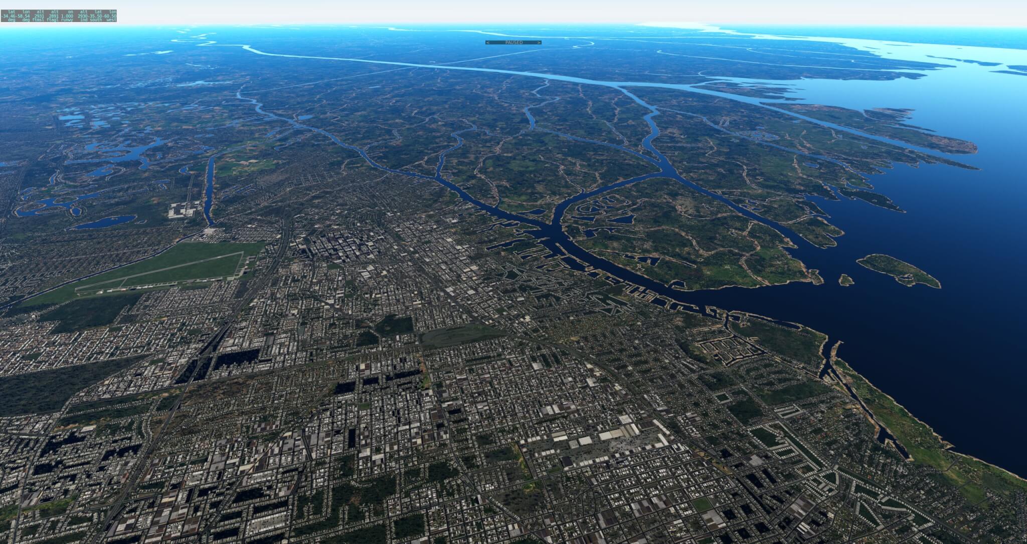
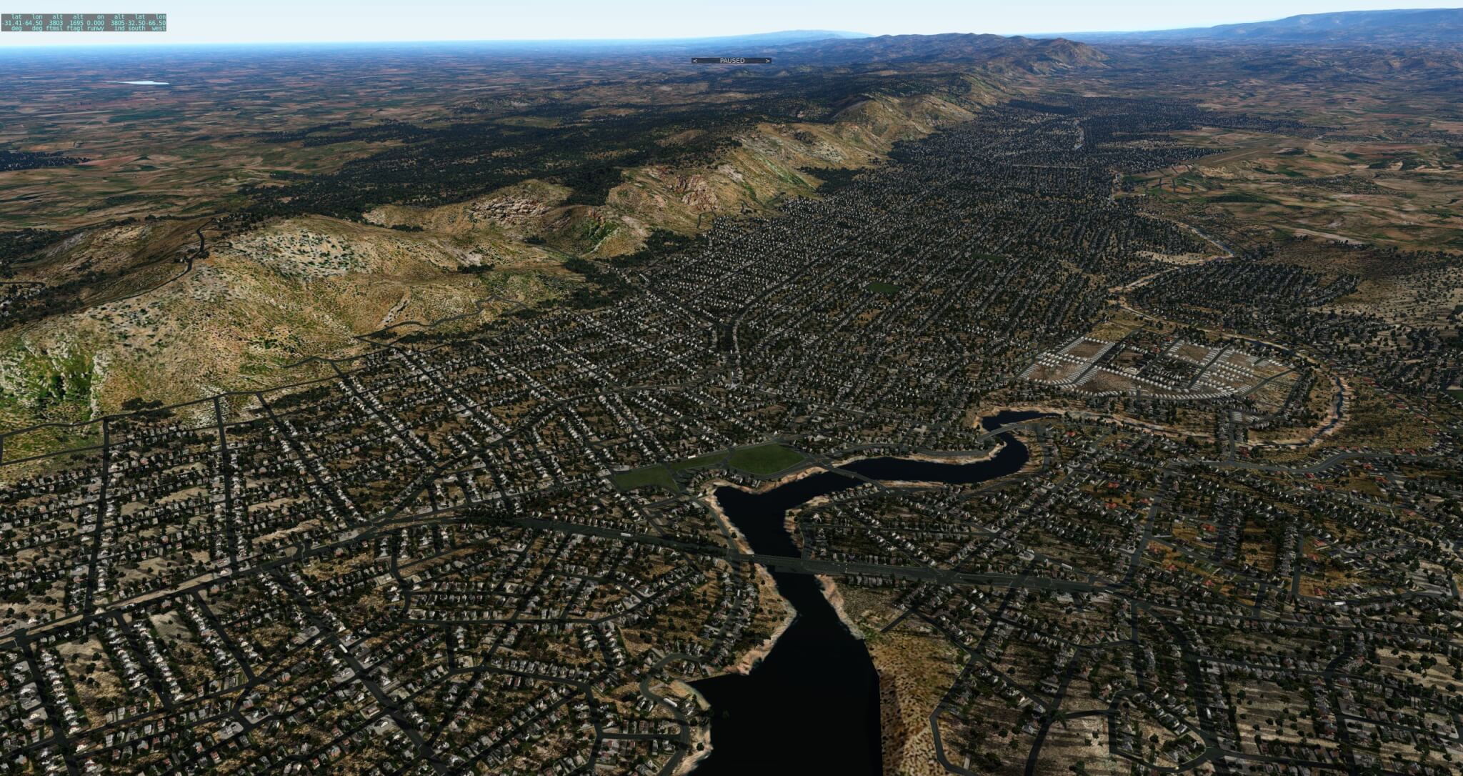

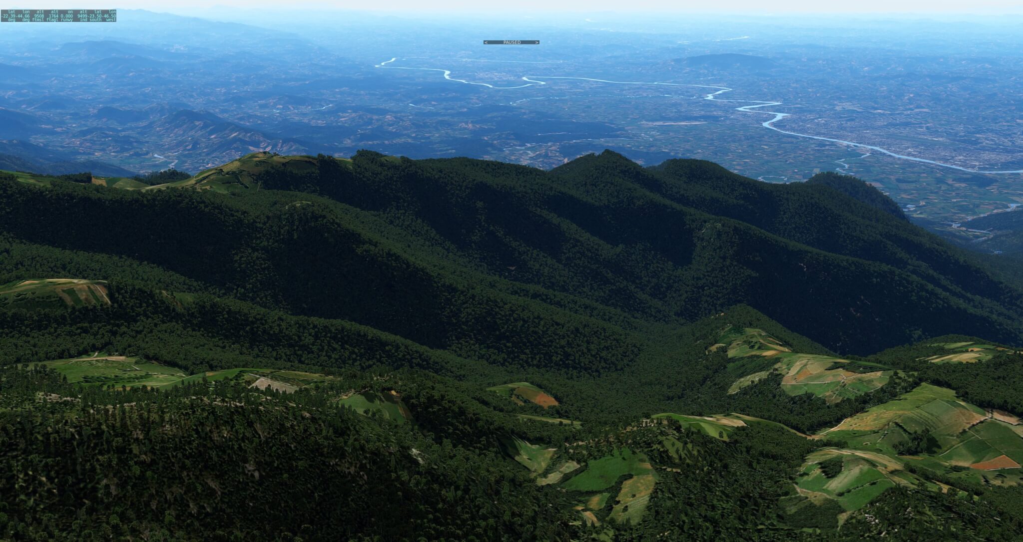
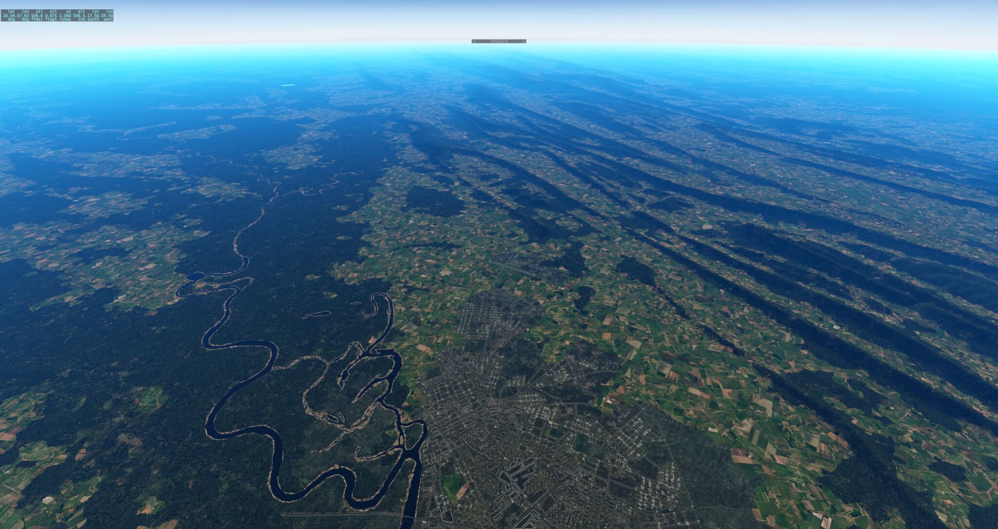
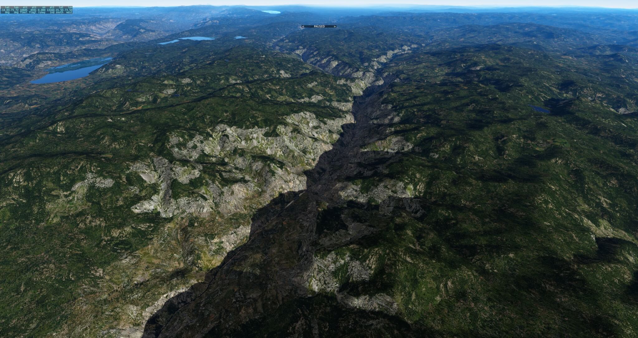
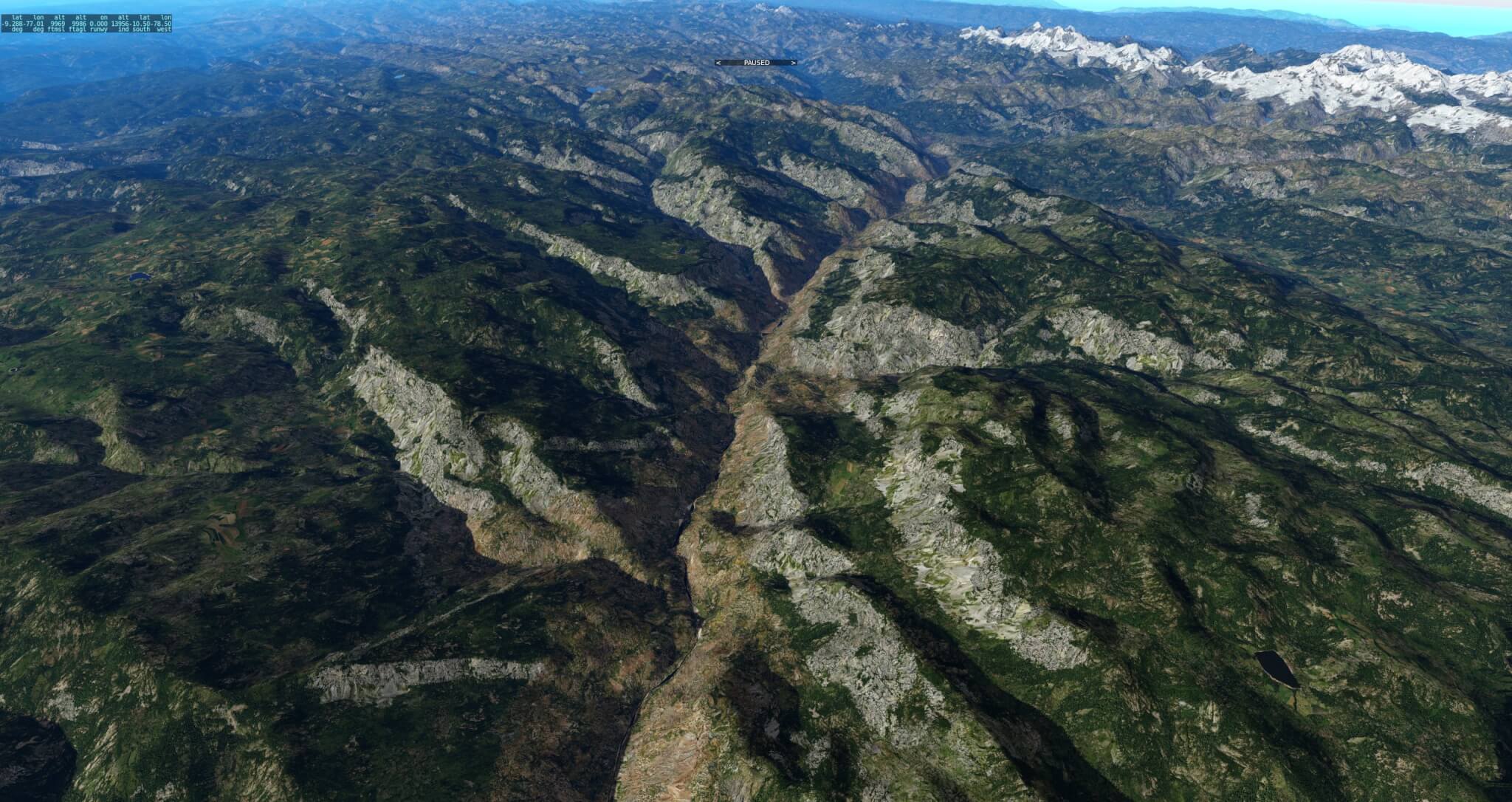
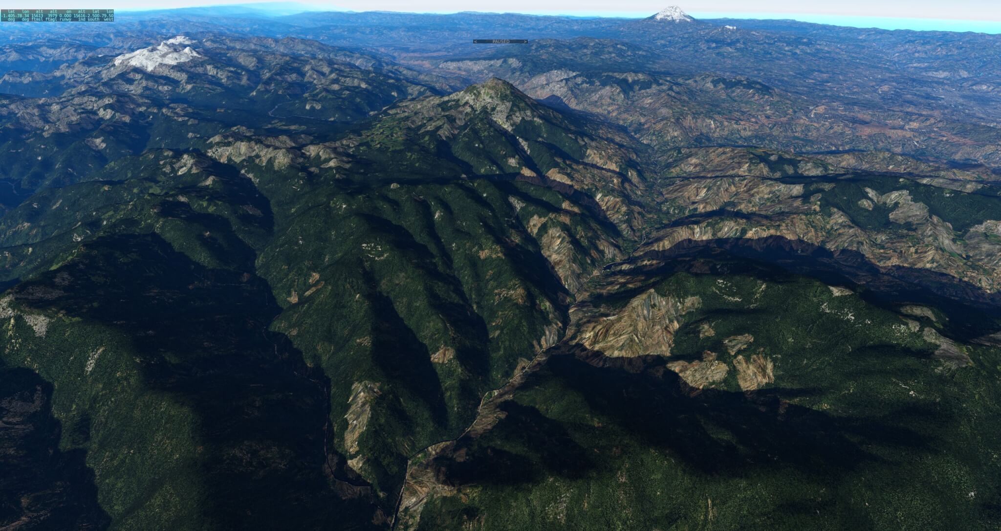
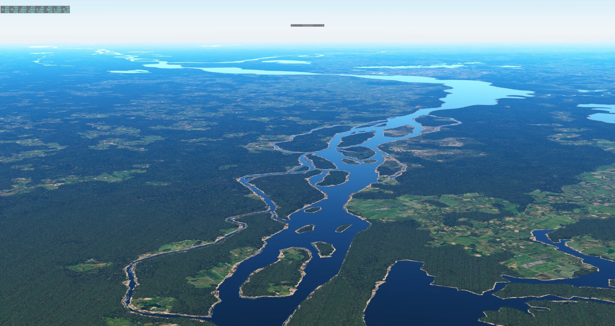
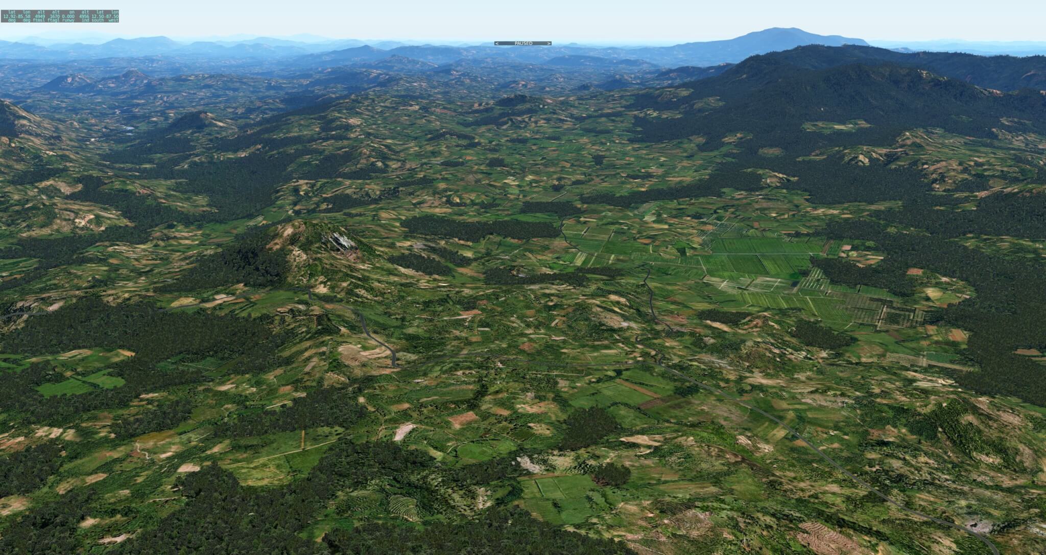
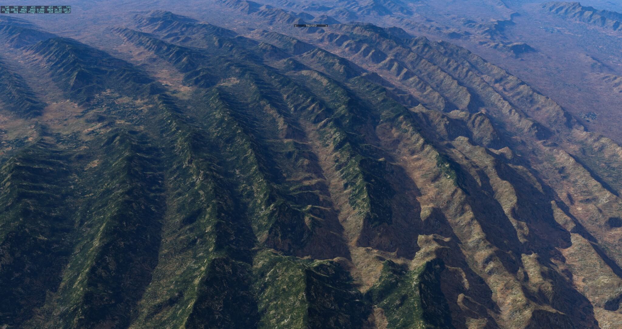

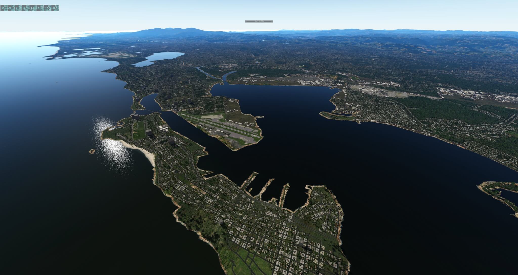
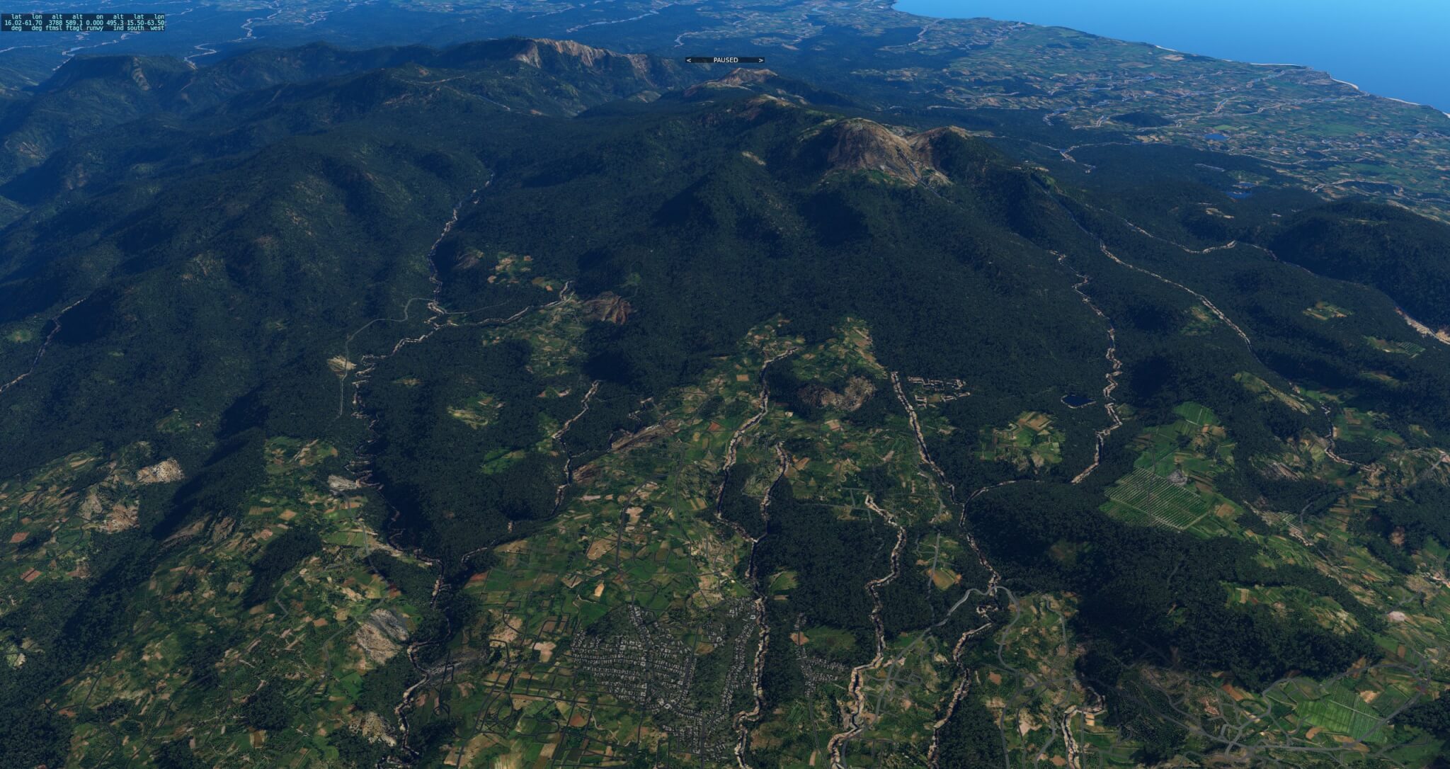
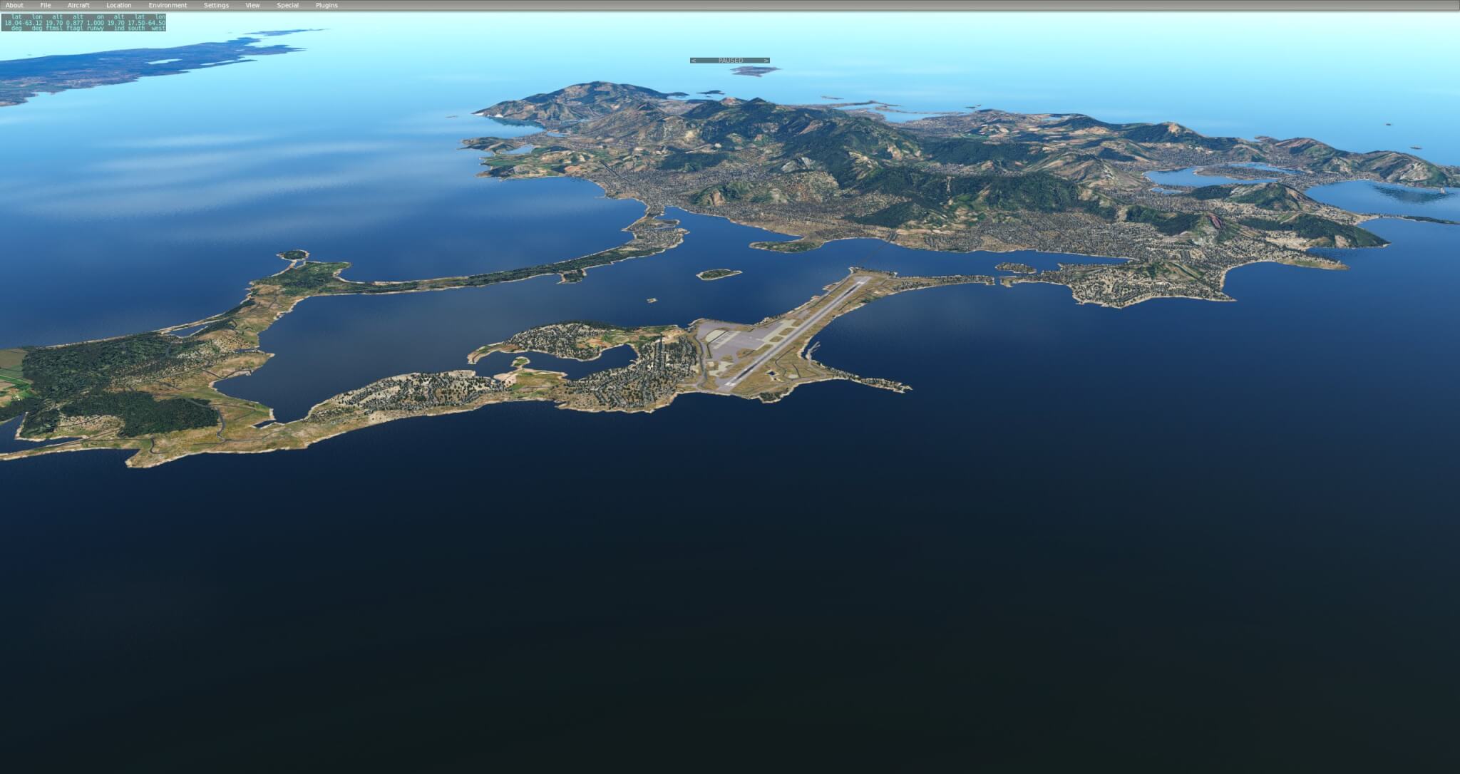
These are of course great and I have used them for a long time.
But I think the Ortho4XP work is incredibly promising and visually far more exciting.
https://www.youtube.com/watch?v=LCmFda8-kHE
Of course, photoscenery CAN be very nice … but one has to see its costs too.
For example: how big do you think would a scenery with high res aerial imagery be for an entire continent (I am taling about Terrabytes not GBytes)? Can that size of scenery easily be distributed (who pays those TBytes of traffic)? And can you always get good quality aerial imagery for all the regions you want to cover? Aerial imagery can introduce a lot of not so nice artifacts etc. (different time of day, different weather, different time of year, different cloud cover …). And can you always pay for all of the aerial imagery (its not always free … especially if you want better quality).
My point is: yes, aerial imagery can be beautiful … but one should never forget, that its not working at all scales and in all regions of the planet (and having its downsides too). Thats where the landclass scenery approach gives you a nice middle ground … Of course often / sometimes not as beautiful as photoscenery can be (but not always is!) … but able to cover large areas at a quite consistent quality level.
I am with Andras, here. I watched some videos of the Ortho4XP and it looks stunning – for certain regions (wilderness). Once you get into areas of human settlement, its limitations start to show quick, like flat, pasted buildings. What about different light levels (cloudy, night, etc.)? What about night lighting (road lights, lit houses)?
Then there is the question of data ownership. Even IF you could somehow distribute data for the whole planet, this data usually doesn´t come for free, and even for seemingly “free” sources like google earth or bing, the licensing is pretty strict, if you read it to the letter. I am sure that even tools like g2XP and Ortho4XP are in the “grey area” of it. Certainly nothing a US based company that is in the target zone of greedy lawers could pursue.
Jan
It’s remind a discussion between the great artist and the not less great photographer. What’s cooler? A picture or a photo? An answer is simple. This is X-Plane allowing to do the amazing stuff to both.
Spot on !
I would add that I have most of Andras sceneries home,
and not just for testing purposes (btw I really like the picture above with the concentric waves ;-). South
America today in particular is surely a poor place for orthophotos.
@Jan Vogel : I guess you are speaking about “naked” orthophotos sceneries (probably because I only
showed those in testing videos), but of course the
same objetcs which you have on landclass sceneries
can (should) be put on orthophoto based sceneries
too. I personnaly use Tony’s excellent World2Xplane
for this, and it really works well with (including shadows etc). An example here :
http://www.avsim.com/topic/477222-denmark-pro/?p=3321295
Also, nowhere Ortho4XP is in the “grey area” since it
does not distribute anything except its source files.
On the user side, an increasing number of governmental
geoportal platforms in Europe are turning copyright friendly (some even going open data, like Denmark in the above example), they are actually enforced to do so by the INSPIRE directive.
Again, a huge thank to Laminar and Ben for having
made the scenery part of X-Plane open and leaving
almost infinite room to people like Andras or others.
That Denmark Pro scenery shows an interesting development in scenery…it’s happened slowly but I’ve been doing this long enough that I remember when this wasn’t true.
We’re reaching a point where source data (vector or photo) is both high enough quality and high enough in positional accuracy that you can mix and match data sources and have a very good chance of it “just working”. The real Earth is the reference to which this data aims, and as the data’s error bars get smaller, you can put OSM over an orthophoto and … things line up. 🙂
When I started making scenery, the only global vector products were VMAP0 and GTOPO30. Both had about 1 km of error (really!) and not in the same direction. So if you combined the two you’d just get stupid things like lakes crawling up mountains, and the scenery code had to do a lot of work to fix these plausibility problems.
The data is getting good enough now that we can throw that code out and just mix it together and let it out the door. 🙂
The combination of the real-world vector buildings on top of the orthophotos look really good. This depends on a bunch of things going right other than the spatial data looking right.
– The resolutions of the 2-d and 3-d can’t be too far apart.
– The saturation/white balance o the 2-d and 3-d textures have to match.
– The lighting queues have to match, which means not having baked shadows from a low-angle sun in the orthophotos.
@Andras
While Ortho4XP was originally designed to build photo sceneries like G2XP, it’s now much more than that and can be used to replace MeshTool for landclass sceneries. It employs a different algorithm that gives (according to its creator) much better results than UHD at half the size of HDv3. The only limiting factor is the GPL licence, but it’s definitely worth a shot.
http://oscar.pilote.free.fr/meshtoolortho4xpcomparison.html
That comparison page shows MeshTool/RF land class meshes and an Ortho4XP mesh with orthophotos. There are no wire frames and no metrics on error. So while it is definitely possibly that Ortho4XP is doing a better job in terms of mesh error efficiency (this would not surprise me – I really haven’t spent any time trying to optimize error metrics in high density meshes) I can’t tell from that comparison. The lighting queues from the ortho-photos are radically different and essentially obscure the X-Plane lighting (which is already soft) due to the hard-baked shadows.
The other necessary element for comparison besides comparative error metrics and wire frames is to include land class transitions for both tools. I don’t know how Ortho4XP handles land class, but for MeshTool, required polygonal terrain changes, water boundaries and keeping the mesh ‘sane’ for land class changes all put pressure on triangle count separately from mesh error. While orhtophotos have their own hard requirements (E.g. hard cut lines at the orthophoto boundaries with no T junctions), this requirement might be more or less strenuous than land class requirements, depending on tile size and complexity of the land class input vector data (if there is any).
Anyway, there’s plenty of room in the ecosystem for land class and orthophotos and more than one tool to generate DSFs. I’m happy to see people generate their own DSFs or to contribute patches to MeshTool.
Patric … first of all, Ben already summed it up quite nicely.
But I would also add a few points.
I think, you are really mixing up a few things here when you say “it’s now much more than that and can be used to replace MeshTool for landclass sceneries” … Because I do not see (nor do I know about it), how Ortho4XP can be used for “landclass”(!!!!!) based mesh. Landclass based scenery – at least to my understanding – means, that you derive your scenery from a handful of land classes (land use / land cover data) and based on this information, try to place a limited set of generic textures (NOT orthophoto). This is a quite complex process if you want to do it right and it needs to make a lot of rule based decisions if you want get a halfway good / versatile result (and this is what MeshTool or the Laminar internal RenderFarm – which I use – does). This is something, which you do not have to do with orthophotos …. because you just pick the aerial photograph of a given place and paste it on the mesh in the right location (and only need to make sure, that the mesh geometry can have that form of texture assigned).
Add to this, that with landclass based mesh, you need to take care of texture transition! If you would just give different textures to bunches of triangle patches next to each other, you would see hard transitions in the sim (at the edge of the triangle patches). To solve this problem, MeshTool (or RenderFarm) add gazillions of additional triangles (redundant overlay triangles) where texture transition takes place … With this technique (where 2 or more triangles overlap) smooth texture transition can take place (and look good). This is something, you do not need with orthophotos … as – as long as the source aerial photographs is of good quality – they are kind of a gigantic continuous “texture” … and as long as their areplaced next to each other correctly, then there are never transition problems AND thus you never need redundant (extra) triangles to take care of this transition. THIS is the reason, why a well crafted orthophoto mesh is always much more efficient than landclass based mesh. Because it does not need a gigantic pile of additional triangles to take care of transitions.
So … everything has its pros and cons 🙂
Hi Andras,
Gazillions triangles as you call them are equally necessary to make transitions between an orthophoto and the X-Plane water (this is the feature I found was lacking in G2XPL and the reason why I started Ortho4XP). More generally, this or any landclass transition amounts to having _ as input _ a bunch of appropriately tagged polygonal boundaries, making a triangulation that respects those boundaries, and then making the (duplicate) triangles pointing towards the right .ter file (as complex and refined theses are).
A hard work in the landclass case (whatever the mesh tool that comes after), the one you are doing with great success , it to collect the input.
I hope it is clearer now.
Incredible shots and quite a testament of what X-Plane is capable off. I am hoping that this level of detail will eventually find it´s way into the “default” X-Plane scenery.
I know it´s a concern performance- and sizewise, but hope springs eternally, and hardware/bandwidth is improving (all but too slowly).
Kudos for showcasing Andras´ work here, too – it would be a shame if anyone misses this release!
Cheer, Jan
South America!!!!! \o/
Thanks Andras!